August 21, 2008
Oregon Trail Diary
Day 4
Distance: 348 miles
Pace: Strenuous
Health: Fair
Weather: Hot
Meals: Meager
(I didn't have a reliable wi-fi connection last night, so this entry is being published a day late. A strained analogy involving the Pony Express is available to subscribers for an additional fee.)
We ended last night on the outskirts of Casper, Wyoming. There are plenty of hotels in Casper, as it is the second-largest city in the state and features a whopping two Wal-Marts, but they were all booked, save for ones offering extremely specific room types (handicapped smoking room with three single beds, one of which is haunted, but it switches from night to night - that sort of thing). The Hampton Inn had a big plate of freshly-baked cookies at the front desk, and I fear I may never fully recover from being denied lodging there. (The excuses I would have found for trips to the lobby...the mind boggles.) A clerk at the Super 8 (also full) referred us to the West Side Hotel, which is on the west side of town, and appeared - based on the sign, color scheme, wood-paneling, and murals from "Yellow Submarine" in the restaurant - to have been opened by hippies in the early 70s, and preserved thereafter as a museum illustrating the sort of hotel that hippies opened in the early 70s.
I found the place charming, fond of wood-paneling as I am, but K. didn't like the mold in the bathroom or the pillows. Well, fair enough. My enthusiasm was significantly dampened at breakfast, when I asked the waitress if the breakfast burrito had any meat in it, and she said 'no', and then brought me a breakfast burrito smothered in ground beef, and we had to have a semantic argument about whether there was a meaningful difference between meat being 'in' the burrito or 'on top of' the burrito. (Are there directional vegetarians?) The aging hippie in the kitchen, thankfully, took my side.
You have reached Independence Rock. Would you like to look around? Y / N
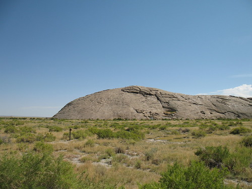
Independence Rock is so named because if travelers reached it by July 4th, Independence Day, they knew they were on pace to reach Oregon before the winter. Although the game and historical accounts refer to it as a major highlight, the state of Wyoming refers to it as a "Rest Area", with an additional small brown sign saying "State Historical Site Independence Rock" directly across from the entrance - very helpful, as long as your car (and all traffic behind you) is cool with going from 70mph to zero in less than a second in order to make an instantaneous turn. The Volks Wagon, however, needs a little more notice than that.
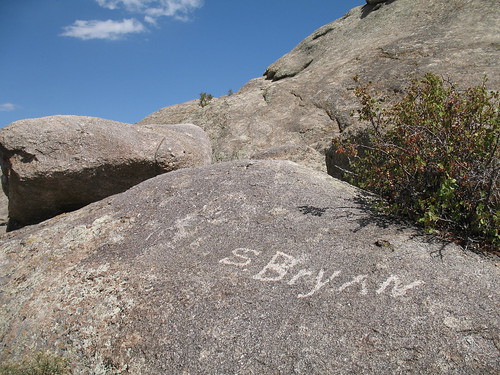
Unlike Chimney Rock, about half of the land around Independence Rock is publicly owned, so you're welcome to have a look around (until you reach the fence, at which point a sign reminds you of the importance of respecting property rights). Travelers on the Oregon Trail usually rested there for a day or two and carved their names into the rock; their names are preserved today, evidently sliding in on the favorable side of that fine line between "historic" and "graffiti". Otherwise, it's mainly a big rock, so you can walk around it and imagine people firing off guns, cheering for their nation and their ability to keep to a schedule.
At this point, we were on Route 220. By taking state roads, which are very well-maintained in Wyoming (and generally decent in Nebraska), it is possible to drive very close to the original Oregon Trail. There are plenty of little markers along the way, ranging from little white marble blocks saying 'Oregon Trail' to the big, grandiose signs of the 1930s and the teacher-chat sequential interpretive displays of the 1980s. (The WPA-era prose on the sign at the Wagon Ruts near Guernsey is particularly exceptional. That anonymous writer saw the whole sweep of history before him and strained to the very limits of the sign genre to get his readers to see it, too.)
Later in the afternoon, we indulged another fascination of mine, ghost towns - or, as they're known in Wyoming, "towns". We had already passed Jefferson City along 220, which I was surprised to find classified as a ghost - there were plenty of deserted structures, including an enticing motel with a top-hat on its weather-beaten sign, but overall, it didn't look any less active than any town we'd seen in the state other than Casper. Now traveling south on Route 287 (and witness to some astonishing mountain views), we turned on a gravel road to find Atlantic City and South Pass City. Both were mining towns that boomed in the 1870s and dwindled thereafter. Today, these roads are nearly impassable to the likes of the Volks Wagon in mid-summer, so I doubt anyone gets in or out during the winter.
K. was not much interested in Atlantic City, but I liked the atmosphere there. It had a hillside clutter of structures, but the small handful of still-occupied buildings were hard to tell apart from the vacant ones, making thorough exploration a dicey option. One billed itself as a cafe, and showed signs of being open; another, with the tall words MONK BIRD KING scrawled in red outside, claimed (in smaller words) to be the studio of a sculptor. Another long-abandoned building had an optimistic 'FOR SALE' sign in the window. We had passed a sign for "Crazy Woman Realty - Buyers Only" earlier in the day, and they have a website - they may know more about the size of the down payment expected, financing options, etc.
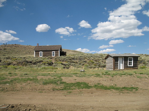
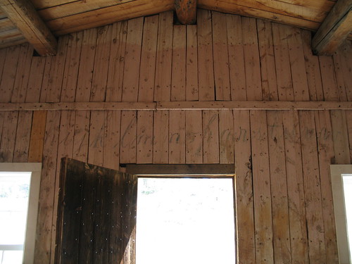
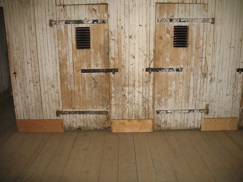
South Pass City is closer to the abandoned mine, which can be seen on a nearby hilltop. (Evidently, there is a state agency dedicated to making sure these abandoned mines don't become a problem.) According to the welcome sign, "about 7" people live in South Pass City today. The state has bought and semi-restored a handful of structures, the few that survived a massive fire after the town went bust around the turn of the century, and some are now mini-museums about the town's history. Others remain vacant, such as a remarkably creepy jail / temporary schoolhouse where the letters of the alphabet can still be seen inside, above the door, facing the dungeon-like cells.
The gift shop had a primitive coloring book about the Oregon Trail (trust me, I would have bought it if it had been worth buying) the same fake gold-panning kit we've already seen a dozen times on this trip, and a stack of lurid romance novels by Wyoming authors.
Impassable trail. Lose 1 hour.
There were more road crews digging for treasure in what appeared to be perfectly serviceable roads, so K. and I entertained ourselves with Chinese fire drills while waiting, and we both spent too damn long behind the wheel before winding up in Jackson for the night. We're off the Oregon Trail now, spending a couple of days at the national parks, which may come back to haunt us in the winter. Wish us well.

Comments
Thank you thank you for visiting ghost towns and taking pictures. One of my keener regrets about the group trip I took West last year was that we blew through the ghost town of Bosler, Wyoming, and I was the only one who noticed.
ghosttowns.com says that Bosler has a furniture store. What kind of furniture do ghost towns go for?
Posted by: Kurt | August 28, 2008 10:39 PM